
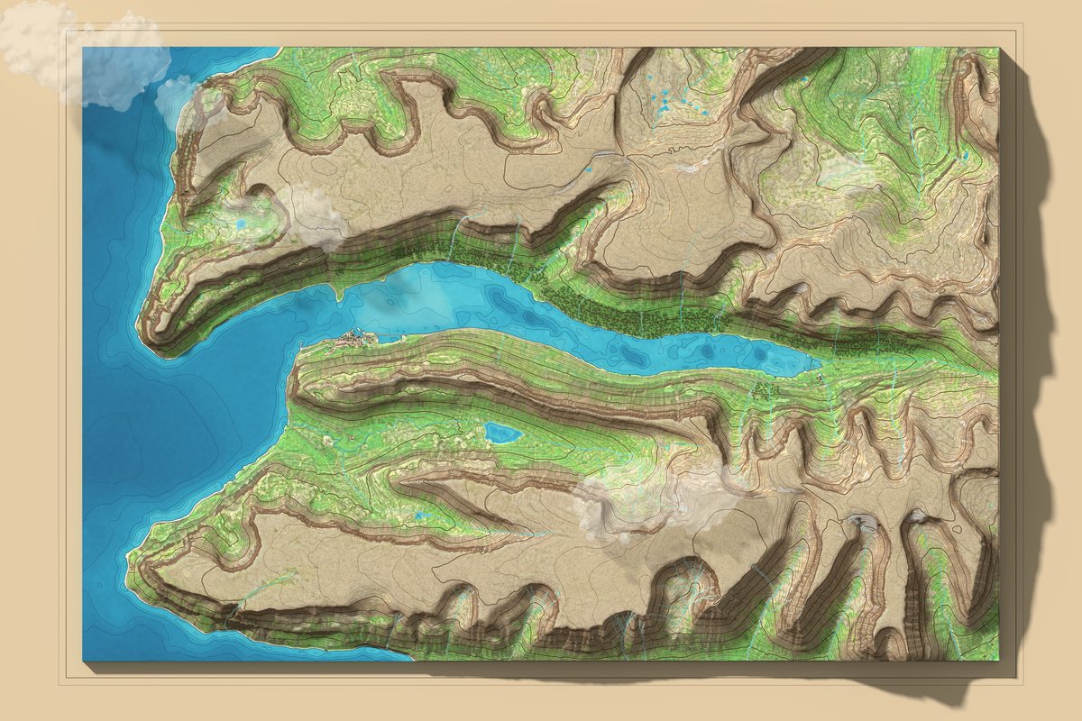
Since late October we have been working on a new map of Súgandafjörður. It is a model of the whole fjord built from real data on the height of the land and the depth of the sea, seen from above like a relief model on paper. It has mountains with shadows, green valleys, rocks along the shore and the village of Suðureyri on its spit.
One map, twenty-eight pieces
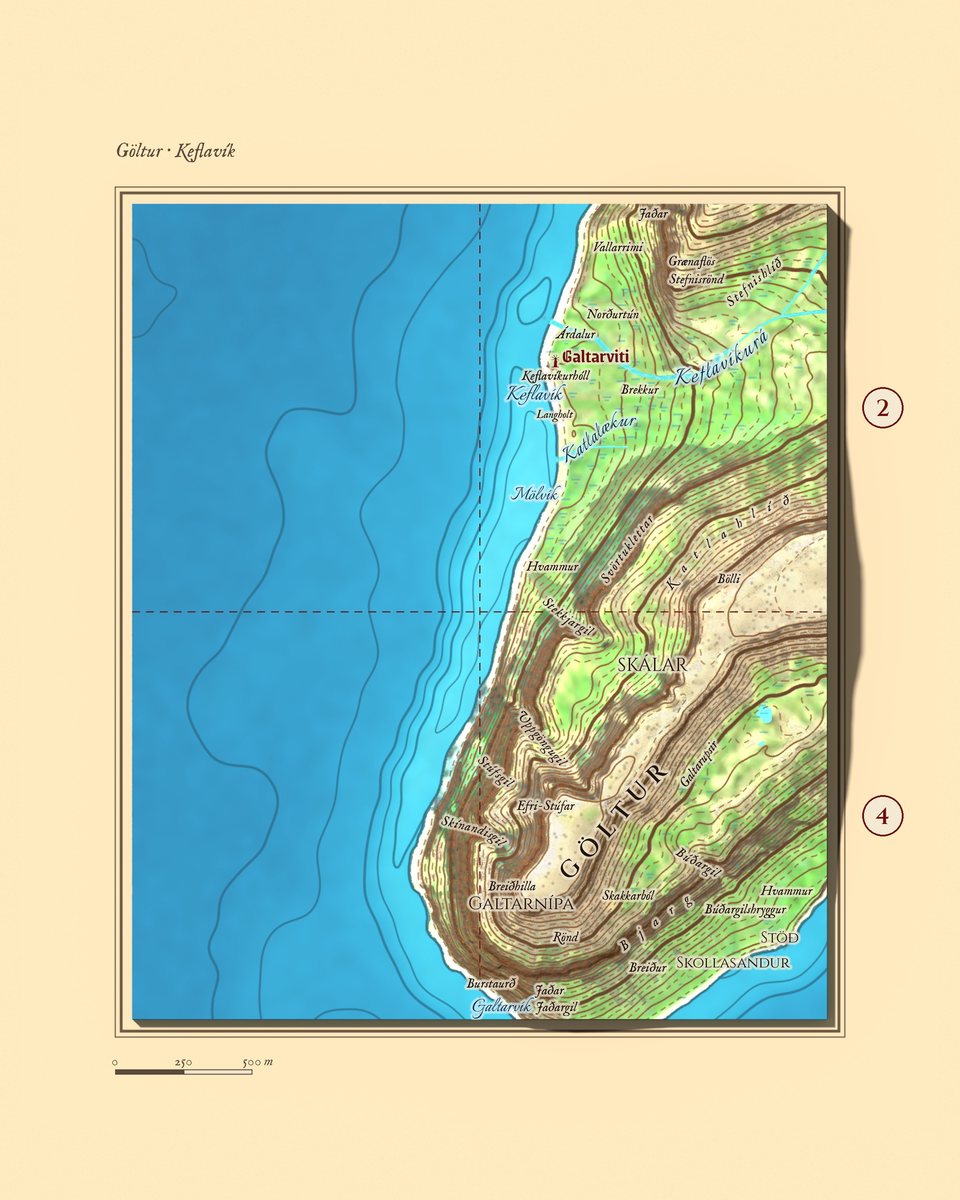
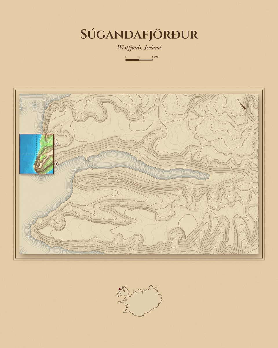
The whole fjord fits on one large A1 sheet. Only the main names fit on it. So we divide it into 28 equal pieces, seven across and four down. Each piece is shown at a larger scale, with every name that lies in it.
Each piece has its own set of sheets: a view of the whole piece, maps of its four parts, a list of names with their meanings and a small map showing where the piece lies in the fjord. Where there are a great many names, we add an extra close-up.
Names from Icelandic sources
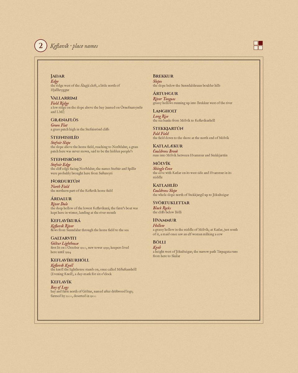
Our list holds more than 800 place names from around the fjord: mountains, gullies, meadows, rocks, bays and old farms. We take them only from Icelandic sources. The main ones are the place-name registers (Örnefnaskrá) compiled by Kjartan Ólafsson, the photographs with marked names on the Örnefnamyndir blog run by Fornminjafélag Súgandafjarðar, and data from Landmælingar Íslands.
We translate every name and check exactly where it lies. There are no dots or arrows on the map. The lettering itself shows the place: a valley’s name runs along the valley, a gully’s along the gully, and a bay’s name sits on the water by the shore. That is how old maps were drawn, and that is how we want to draw this one.
What is ready
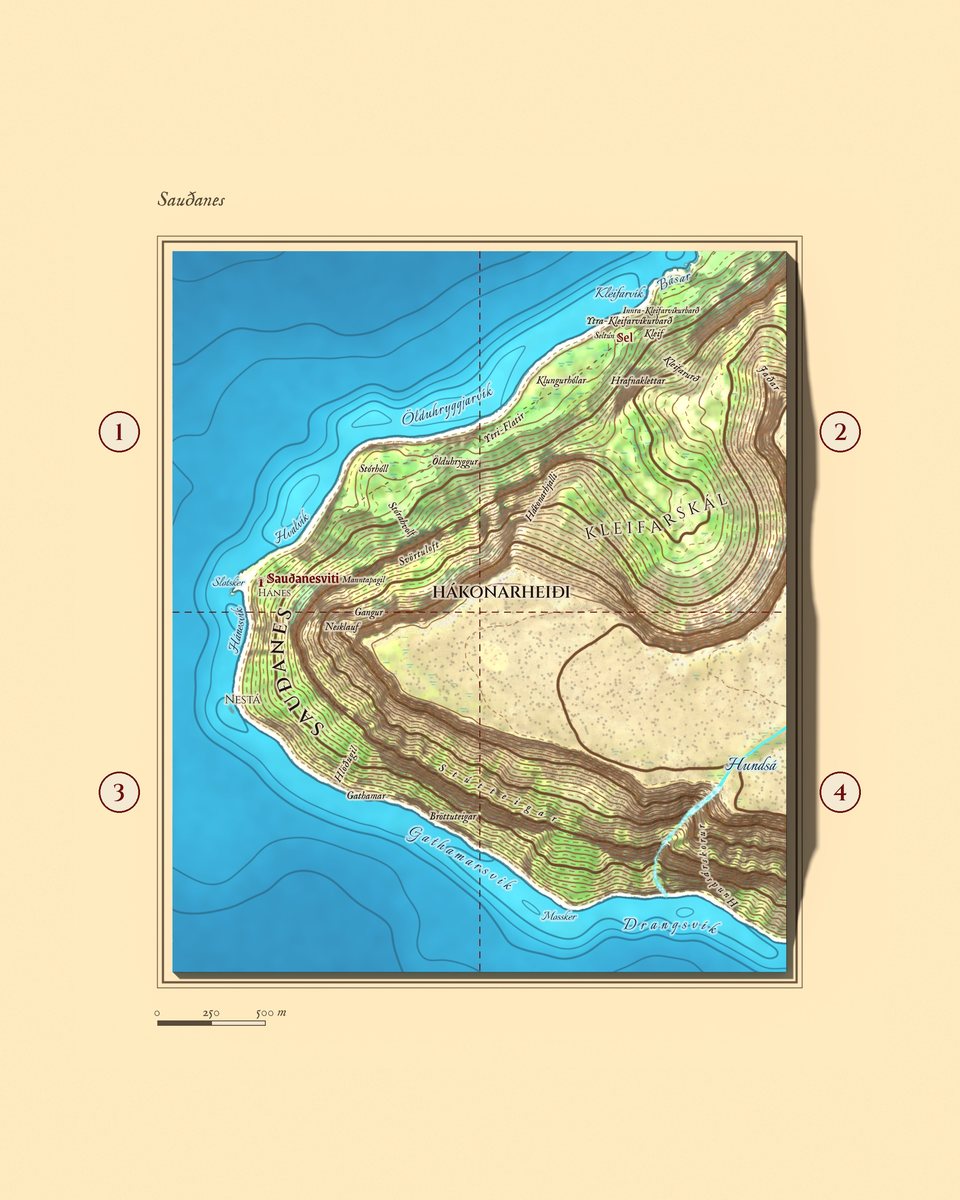
First came the headland Sauðanes with the lighthouse Sauðanesviti. Then Göltur, the mountain at the mouth of the fjord that looks like a boar’s head from the sea, and the bay Keflavík behind it. Both sets are on our Instagram and Facebook, with a short film that flies over the map from the fishing hut Ársól to the lighthouse.
In April 1896 Magnús Hjaltason walked the stony shore under the cliffs of Göltur, with stones falling past his shoulder. In his diary he called it “hinn skelfilegasti vegur”, the most terrible road he had ever taken.
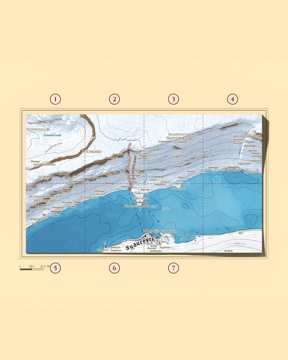
Our profile also shows the farm Norðureyri, across the water from the village, shown in winter with its avalanche paths. The avalanche historian Ólafur Jónsson wrote that probably no farm in Iceland was struck by avalanches as often. Their waves crossed the fjord all the way to Suðureyri. The most recent came in January 2020. It broke over the sea wall and ran 30 to 35 metres inland.
Also ready are the land around Leiti and Staður, with Ársól as a 3D model, and the slope with the waterfall Mígandi. Norðureyri in summer, with every name and its story, will follow in a separate post.
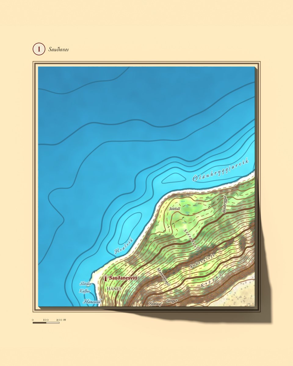
This autumn a Coast Guard radar went up on the plateau above Sauðanes, and a backup fibre-optic cable to Suðureyri is being laid across the headland, to be finished next summer. We have added both to our map.
What comes next
Next is the village of Suðureyri itself and the land around it. Then more pieces further into the fjord, until the whole map is complete.
If you know these places, help us. A reader noticed that the skerry Kerlingarsker by the breakwater, which shows at low tide, was missing. We found it in the place-name register for Suðureyri, and it will go on the map. If a name is in the wrong place or you know a story we are missing, write to us. Every correction goes back into the map.
Names: Örnefnaskrá (Kjartan Ólafsson and the works he cites), the Örnefnamyndir blog (Fornminjafélag Súgandafjarðar), Landmælingar Íslands IS 50V. Map data: ArcticDEM elevation (Polar Geospatial Center), the source of ÍslandsDEM; Landmælingar Íslands; Náttúrufræðistofnun; Land og skógur; Copernicus Sentinel-2; EMODnet Bathymetry; © OpenStreetMap contributors (roads and buildings).
Back to news